Pictometry Set to Capture Digital Terrain Data for Final Phase of Los Angeles County Consortium's Mapping Project
Slated to begin later this year, the project will capture and deliver LiDAR in accordance with USGS Quality Level 2 specifications.
Bothell, Washington June 03, 2015
EagleView Technology Corporation, a leading technology provider of aerial imagery, data analytics and GIS solutions, announced that its wholly owned subsidiary, Pictometry International Corp., secured an order from the Los Angeles Region - Imagery Acquisition Consortium (LARIAC) to provide digital terrain datasets through LiDAR capture of the 4,000+ square mile area that makes up Los Angeles County.
Slated to begin later this year, the project will capture and deliver LiDAR in accordance with USGS Quality Level 2 specifications. At two points per square meter, this will equate to over 21 billion individual measurements of elevation across the County. Pictometry will also provide the consortium with a number of derivative digital terrain datasets, including a digital terrain model, digital elevation model, digital surface model as well as one and two foot contours of the project areas. "We are looking forward to the LiDAR capture which will be the final phase of the LARIAC4 imagery and mapping project," stated Mark Greninger, Geographic Information Officer, County of Los Angeles. "The digital datasets when combined with Pictometry aerial imagery and our geographic data will provide powerful intelligence and information for all the members of LARIAC."
The LiDAR project will allow consortium members access to the digital data and imagery for use in 3D modeling, floodplain and watershed mapping, disaster management, land use planning, transportation planning, volumetric studies, solar modelling, vegetation analysis, sustainability planning, and more. "The elevation data will provide the County and consortium members a core of authoritative, high quality data that will be critical for mapping, analysis, and support of the Countys mission" explained Greninger. "These datasets will be included in our enterprise GIS system, available both internally and externally to allow for more cost-efficient operations."
Pictometry President of Government Solutions, Robert Locke, said that the project represents a natural progression in the long-term business relationship the company has with the consortium. "We are pleased that the County of Los Angeles recognizes Pictometrys expertise and ability to provide LiDAR and digital models," stated Locke. "While known as the leader in aerial image capture, Pictometry is also extremely qualified and experienced in LiDAR capture and delivery."
Pictometry completed most of the LARIAC4 mapping and image acquisition project during 2014, with the remainder to be completed in 2015.
About EagleView
EagleView Technology Corporation, through its two wholly owned subsidiaries, EagleView Technologies, Inc. and Pictometry International Corp., is the unparalleled provider of aerial imagery, data analytics and GIS solutions serving the commercial, government and public utility sectors. The companys patented image capture processes and 3D modeling algorithms coupled with property-centric analytic tools empower end-user workflows with scalable, efficient and highly accurate answer sets in support of property claims, risk management, construction, emergency response, assessment, corridor mapping and more. For more information contact (866) 659-8439 or visit http://www.eagleview.com or http://www.pictometry.com.
About LARIAC
LARIAC is comprised of 20 county departments, 39 cities and fifteen other agencies and educational institutions. In its tenth year, the group is cited as a highly recognized model for regional cooperation.
Featured Product

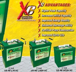
U.S. BATTERY RENEWABLE ENERGY SERIES DEEP CYCLE BATTERIES
Our RE Series batteries are designed to provide the highest peak capacity, longest cycle life, and greatest reliability for use in industrial or residential renewable energy applications. Renewable Energy Series batteries utilize the company's exclusive XC2™ formulation and Diamond Plate Technology® to create the industry's most efficient battery plates, delivering greater watt-hours per liter and watt-hours per kilogram than any other flooded lead-acid battery in the market. Our Deep Cycle batteries are engineered to work with solar panels as well as other renewable energy applications.
